


Feedback on the draft land-use plan of the Springbank Off-stream Reservoir (SR1) project is being accepted until Mar. 17.
When finalized, it will guide future use of the project lands, which include the dry reservoir, diversion infrastructure, diversion channel, and dam structure.
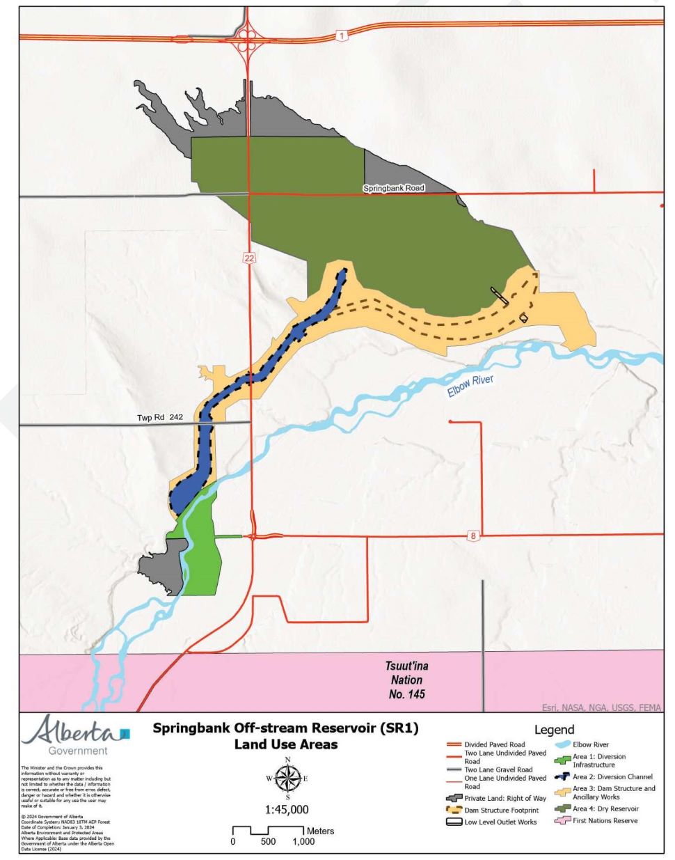
The draft land-use plan includes:
- the location and context of the project lands
- restricted access areas to ensure safety and the successful operation of water management infrastructure
- closure scenarios to restrict general access during periods of increased risk to public safety, during operational activities or to manage environmental sensitivities
- policy direction for First Nations’ priority access and use of the project lands
- policy direction for public access and use of the project lands
When the project lands are not being used for flood mitigation or operational activities, First Nations will have priority access for the exercise of treaty rights and traditional uses. Public access and other uses, such as non-motorized recreational activities, will also be permitted.
The draft land-use plan reflects input received from Indigenous communities and organizations, local municipalities, community organizations, local landowners and other stakeholders through participation in two land use committees. The committees started meeting in early 2022.
The plan is subject to revision and updates where required until it has been approved. It's expected to be completed by spring 2024.
The project lands cover an area of approximately 1,566 hectares (3,870 acres).
Review the draft land use plan and find engagement opportunities at Springbank Off-stream Reservoir Land Use Plan engagement.


 Thu, May 2, 4:30 PM
 Full-time, Part-time, Retail